Two views of Las Vegas
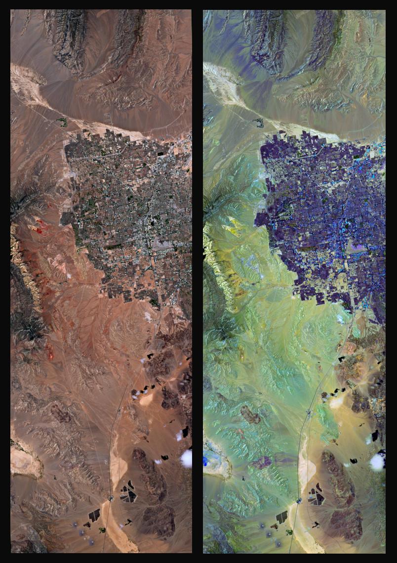

These two images show a large part of the city of Las Vegas and parts of its surroundings. One is a true colour representation (left) and one is a false colour representation (right). The images were acquired by the German environmental satellite EnMAP, which captured a 41-kilometre by 122-kilometre image strip of the region on 12 July 2022. The total area is approximately 5077 square kilometres.
Las Vegas is the largest city in the US state of Nevada. It is located in the Mojave Desert, which is also home to the famous 'Death Valley'. The Red Rock Canyon National Conservation Area (left in the images) is located just under 30 kilometres west of Las Vegas. The colourful rock formations in this area have hues ranging from light sandstone to dark red – the red hues can be seen very well in the true colour representation. In the false colour representation, the colour shades range from dark green to light yellow to beige. Blue and turquoise areas are visible in some places. This makes it possible to identify and subsequently analyse different rock and surface structures of the desert.
Related links
About the EnMAP mission
The EnMAP (Environmental Mapping and Analysis Program) environmental mission is conducted by the German Space Agency at the German Aerospace Center (Deutsches Zentrum für Luft- und Raumfahrt; DLR) in Bonn on behalf of the Federal Ministry for Economic Affairs and Climate Action (BMWK). OHB-System AG was commissioned with the development and construction of the satellite and the hyperspectral instrument. The mission is under the scientific leadership of the GeoForschungsZentrum Potsdam (GFZ). Three DLR institutes and facilities have been commissioned with the construction and operation of the ground segment: The German Space Operations Center in Oberpfaffenhofen carries out and monitors satellite operations. The German Remote Sensing Data Center and the Remote Sensing Technology Institute receive, calibrate and process and archive the satellite data and make them available for academic research.