Bird's-eye view of Schiaparelli – flying around a giant Martian crater
August 19, 2026 | Mars Express mission
Bird's-eye view of Schiaparelli – flying around a giant Martian crater
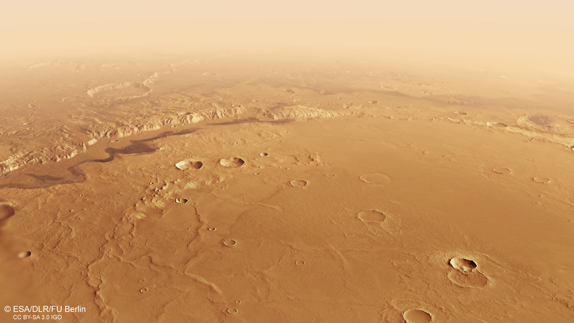
Schiaparelli impact basin on Mars, filled with deposits
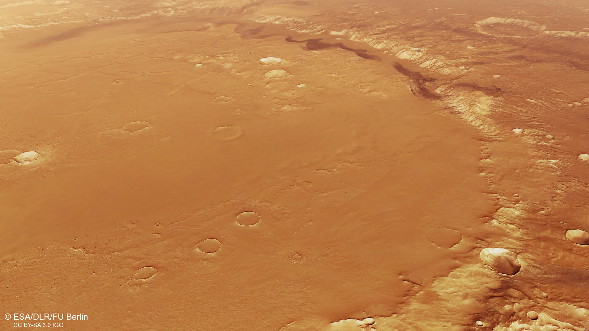
The rim of the 450-kilometre-wide Schiaparelli crater impact basin stands at only approximately two kilometres high. As a rule of thumb, the ratio of crater diameter to crater depth is around 10:1, meaning that after the impact of an asteroid up to 40 kilometres in size, Schiaparelli was initially a depression around four to five kilometres deep. Volcanic deposits, lake sediments and material carried in by the wind are likely to have filled the basin over the past three to four billion years. This can be seen, among other things, in the small craters within the crater floor, which are filled with deposits almost up to their rims. The crater rim itself is already heavily eroded.
Route of the virtual flight over Schiaparelli and the surrounding regions of Mars
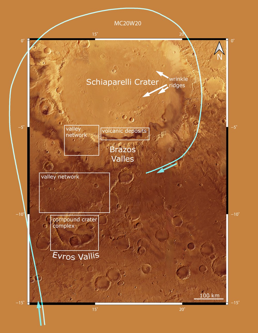
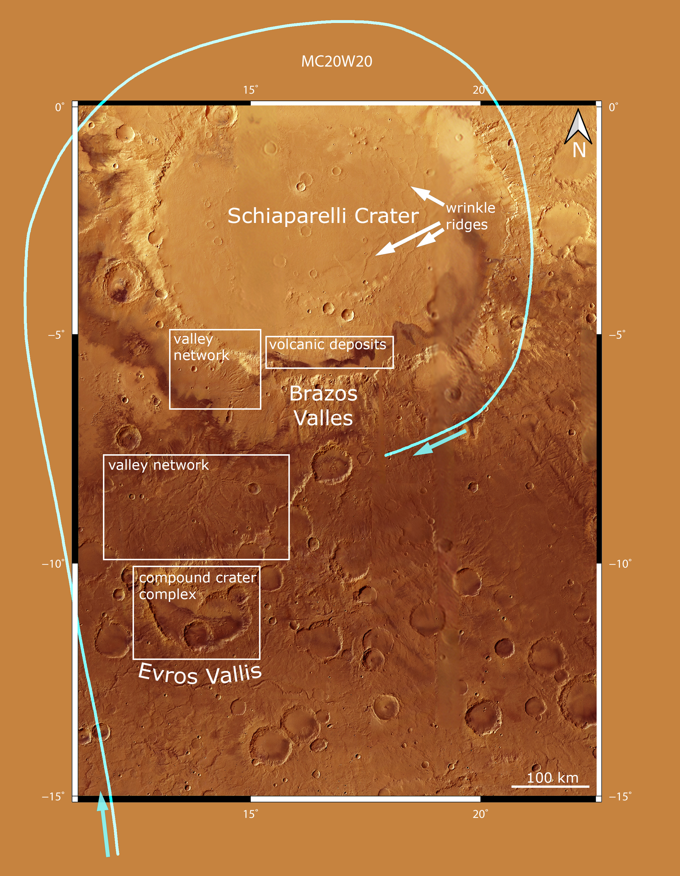
Animated using digital HRSC terrain models, the flight begins in the southwest of the impact basin, near Evros Vallis – a branching valley system more than three billion years old. The route crosses several other dried-up river valleys before sweeping in a wide arc along the western rim of the Schiaparelli crater and finally over its northern rim to the eastern rim, which rises some 2000 metres above the infilled basin. The virtual flight ends at Brazos Valles, a network of valleys extending for almost 400 kilometres along the southern rim of Schiaparelli.
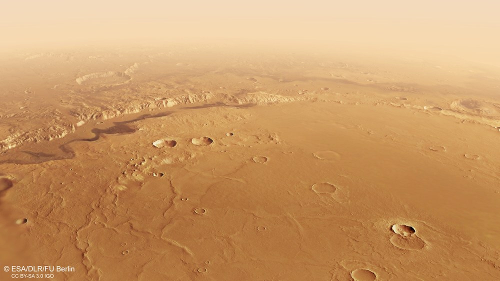
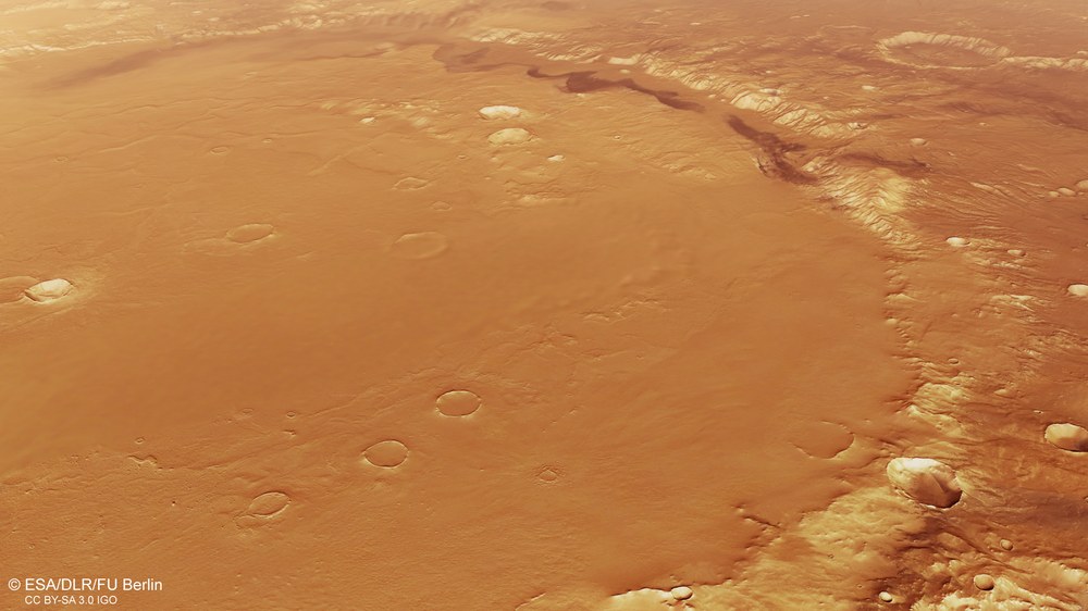
Volcanic sands on the southern rim of the Schiaparelli crater on Mars
The 450-kilometre-wide Schiaparelli basin should actually be much deeper than the two kilometres measured today. Lava, sediments carried in by rivers, and deposits left by wind have likely filled the basin. A clear sign of volcanic activity is the 'wrinkle ridges' visible in the left half of the image, which form when free-flowing lava is pushed up into rock barriers several tens of metres high as it cools. In the background is a striking band of black volcanic sand, deposited by the wind on the windward side of the Schiaparelli crater rim.
A new video based on image data from the German HRSC stereo camera shows a flight over the Schiaparelli crater and surrounding areas on Mars.
Despite its large diameter of 450 kilometres, the crater is shallow.
Deposits from wind and water, as well as volcanic activity, are possible causes of infilling.
HRSC is a camera experiment developed by DLR carried aboard the European Mars Express orbiter.
Since 2004, HRSC has been sending high-resolution image data of Mars to Earth, from which digital terrain models are generated.
Focus: Spaceflight, exploration, Mars
With an extensive flight around one of the largest impact craters on Mars, this new video takes viewers on a virtual journey across the southern highlands of our neighbouring planet. The star of the show is the Schiaparelli crater. The film was created using data from the High Resolution Stereo Camera (HRSC), developed and operated by the German Aerospace Center (Deutsches Zentrum für Luft- und Raumfahrt; DLR). Flying on board the European Space Agency's (ESA) Mars Express orbiter mission, HRSC has been sending data from the Martian surface and atmosphere back to Earth for more than 20 years. The image data helps generate colour images and digital terrain models (DTM), which are used to map the Red Planet and visualise its surface in three dimensions. This makes it possible to reconstruct geological processes during Mars' early history.
This video takes viewers on a journey across the southern Martian highlands to the Schiaparelli crater. The virtual flight begins in Evros Vallis, heads north to a compound crater complex and then passes over the southern part of Schiaparelli's extensive valley network. The video was created using data from the German HRSC camera on board the European Mars Express mission.
Animation: HRSC camera – flight over the Schiaparelli crater
Your consent to the storage of data ('cookies') is required for the playback of this video on Quickchannel.com. You can view and change your current data storage settings at any time under privacy.
Animation: HRSC camera – flight over the Schiaparelli crater
This video takes viewers on a journey across the southern Martian highlands to the Schiaparelli crater. The virtual flight begins in Evros Vallis, heads north to a compound crater complex and then passes over the southern part of Schiaparelli's extensive valley network. The video was created using data from the German HRSC camera on board the European Mars Express mission.
Credit:
ESA/DLR/FU Berlin CC BY-SA 3.0 IGO
The journey begins in Evros Vallis, south of Schiaparelli. From there, it heads north towards a complex of several unnamed craters before a vast, former network of river valleys comes into view south of Schiaparelli. The crater rim is then crossed from the west, followed by a clockwise turn offering a view into the crater's interior. Here, several 'wrinkle ridges' of volcanic origin, as well as smaller craters, can be seen. The video sequence ends with a steep ascent over Brazos Valles, which has been carved directly into the southern slope of the Schiaparelli crater.
This impact basin was named after the Italian astronomer Giovanni Schiaparelli (1835–1910) in recognition of his extensive observation and mapping of Mars. Among other things, he is credited with coining the term 'canals' (Italian 'canali', or channels) for the features on Mars, which he discovered and mapped during a favourable, close opposition of Mars to Earth in 1877. For many years, this map was the best of its kind and regarded as a reference work.
Why is 'Schiaparelli' so shallow?
The immense diameter of the Schiaparelli crater – around 450 kilometres – is roughly equivalent to the distance from Berlin to Essen. Although it is one of the largest craters on Mars, it is relatively shallow at only approximately 2.5 kilometres deep – which at first seems surprising: the body that struck this spot must have been enormous, ranging from 30 to 40 kilometres across, and would have caused a correspondingly deep 'hole' – impacts of this size can leave behind basins five or more kilometres deep. This is likely to have been the case with Schiaparelli too. A logical explanation for its current shallow depth is that Schiaparelli has been heavily filled in over the last few billion years. This is evident from wind-blown sediments and lava deposits, as well as material carried here by rivers that settled in a former lake within the crater.
On the crater floor are several large, sinuous ridges, known as 'wrinkle ridges'. These provide evidence that the crater was once filled with lava, as these characteristic ridges form when layers of lava cool and consequently shrink. The large, dark, undulating band near the southern crater wall is most likely also of volcanic origin, consisting of dark sand that was blown here and deposited by the wind.
Background info
This film was created using a mosaic of images from the High Resolution Stereo Camera on board Mars Express. The dataset from HRSC Mars Chart 30 (HMC30; Quadrangle MC-20W) was combined with topographical information from the stereo camera's digital terrain model (DTM) to generate a three-dimensional landscape. The view is centred on 8 degrees South and 17 degrees East. For every second of the film, 50 individual frames are rendered, following a predefined camera path through the scene. For clarity, elevation differences in the animation have been exaggerated by a factor of three. Atmospheric effects such as clouds and haze have been added to conceal the boundaries of the terrain model. The haze begins to build up at a distance of 250 kilometres.
HMC30 products include multi-orbit DTMs and orthorectified image mosaics generated from individual HRSC images, as well as derived products such as pan-sharpened colour mosaics. 'Orthorectification' is the technical term for the geometric correction of an image to remove relief distortion, sensor artefacts and other perspective distortions.
The HMC30 data products are organised according to a modified version of the USGS MC-30 tiling scheme used by the USGS Astrogeology Science Center. They are based on a bundle block adjustment of the stereo images and are registered to the global MOLA reference frame, the elevation reference frame for the entire surface of Mars, based on the Mars Orbiter Laser Altimeter.
The High Resolution Stereo Camera was developed at DLR and built with contributions from industry (EADS Astrium – now Airbus –, Lewicki Microelectronic and Jena-Optronik). The research team, led by Principal Investigator Daniela Tirsch, comprises 50 co-investigators from 35 institutions and 11 countries. The camera is operated by the DLR Institute of Space Research (formerly the DLR Institutes of Optical Sensor Systems and Planetary Research) in Berlin-Adlershof.