Where lava flowed and winds blow – HRSC view of Mars' Amazonis Mensa region
October 14, 2026 | Mars Express mission
Where lava flowed and winds blow – HRSC view of Mars' Amazonis Mensa region
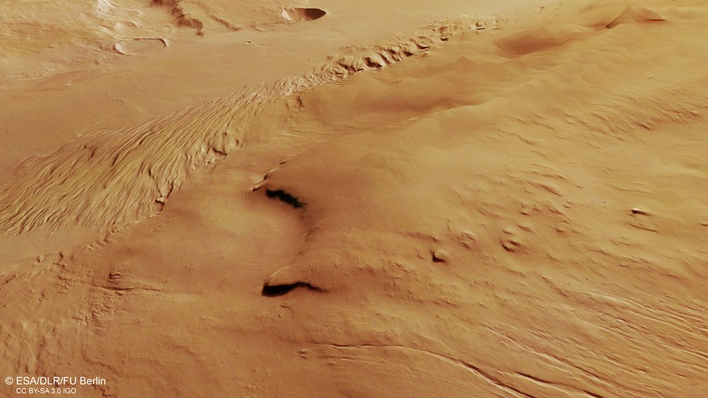
Amazonis Mensa on Mars
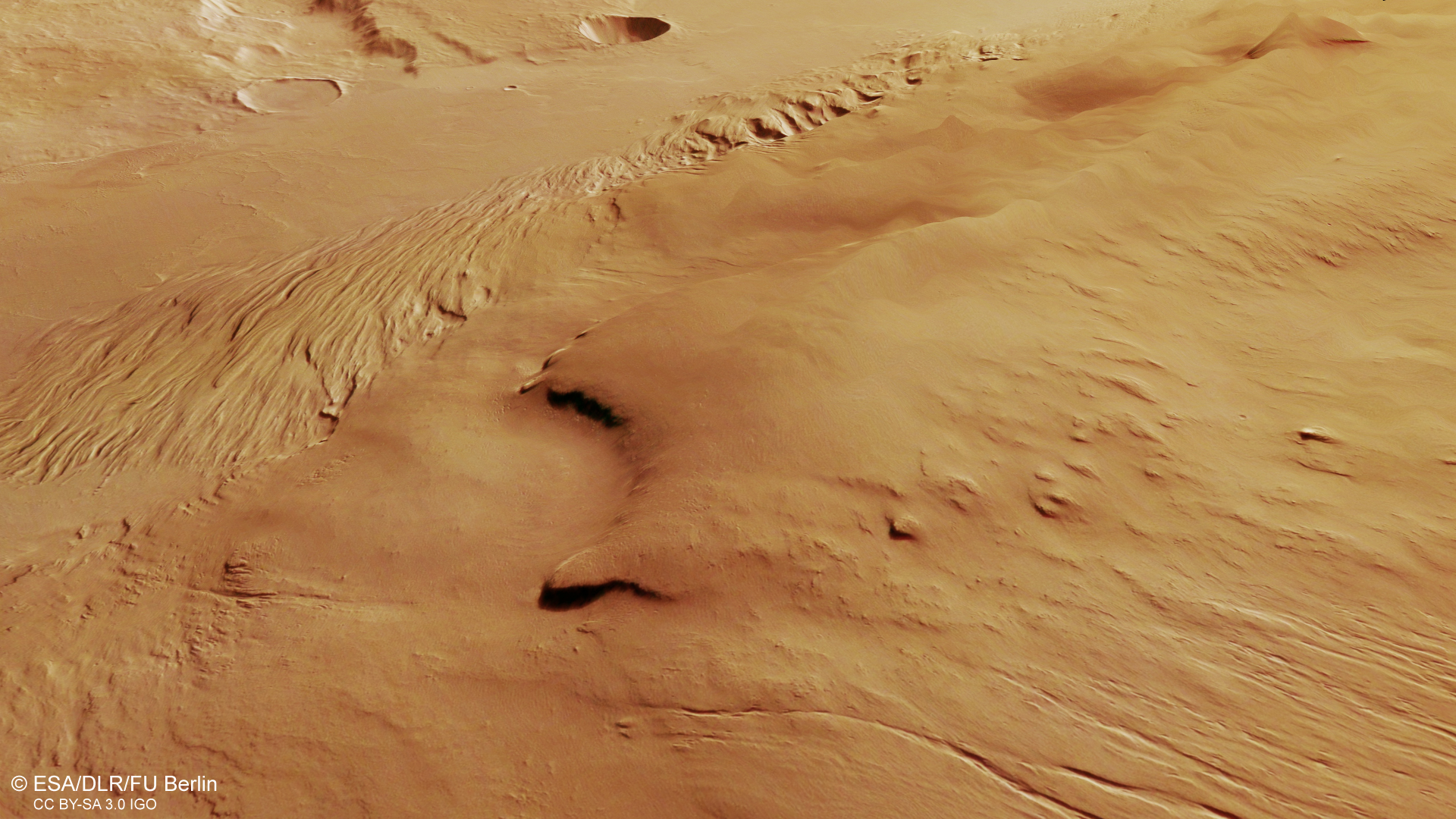
Amazonis Mensa is a prominent mesa more than 400 kilometres long, part of which is shown in this image. Spurs on its southern edge are clearly visible in the centre of the image. Alongside them extend narrow ridges, arranged in different directions around the elevated landform. These are 'yardangs', carved out by the erosive force of the wind over long periods of time.
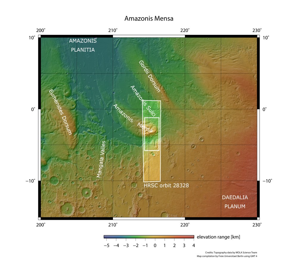
Overview map of the Martian region around Amazonis Mensa
The map shows the area imaged by the High Resolution Stereo Camera (HRSC) on 14 June 2026, with the mesas Eumenides Dorsum and Amazonis Mensa and Gordii Dorsum, characteristic ridges at the transition from Daedalia Planum – part of the prominent Tharsis volcanic region – to the lowlands of Amazonis Planitia. The scale below the map illustrates the large differences in elevation between the mountains and their surroundings.
Image: 2/6, Credit:
NASA/JPL/USGS/MOLA; FU Berlin
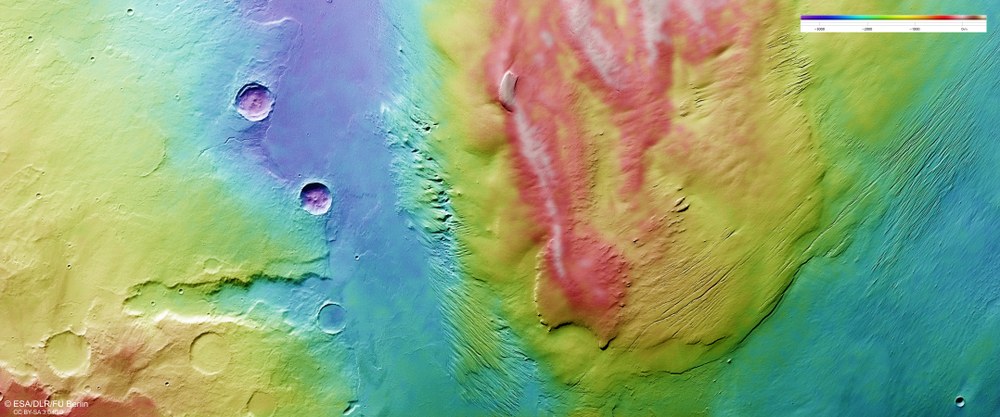
Elevation differences between Amazonis Mensa and its surroundings
This colour-coded digital terrain model of Amazonis Mensa and its surroundings was created using data from the nadir channel and the stereo channels of DLR's HRSC. The colour scale in the top right of the image shows that Amazonis Mensa rises approximately 3000 metres above the surrounding landscape.
New images from the HRSC, the German stereo camera on board the Mars Express mission, show a region at the transition from Daedalia Planum to the lowlands of Amazonis Planitia.
The images focus on the southern part of the Amazonis Mensa and its surroundings.
The region has a long history of volcanic activity and wind erosion.
The prominent linear ridges and impact craters of varying sizes are particularly striking.
Focus: Exploration, Mars, HRSC camera
New images from the High Resolution Stereo Camera (HRSC) on board the European Mars Express mission take us to a region close to the Martian equator, where peculiar, elongated mountains stretch across the landscape like fingers. The HRSC is a camera experiment developed and operated by the German Aerospace Center (Deutsches Zentrum für Luft- und Raumfahrt; DLR).
The area shown lies at the transition from Daedalia Planum, part of the prominent Tharsis volcanic region, to the lowlands of Amazonis Planitia. The HRSC images depict the southern part of Amazonis Mensa and its surroundings. The name 'Mensa' is derived from the Latin word for 'table' and, in planetary geology, refers to a flat-topped mountain, or mesa. Alongside Gordii Dorsum to the east and Eumenides Dorsum to the west, Amazonis Mensa is one of three prominent ridges in this region. Although it is the smallest of the three, it still stretches for more than 400 kilometres. All three structures are elongated and slope gradually down towards the lowlands. The difference in elevation between the highest and lowest points of Amazonis Mensa is approximately 2600 metres.
A changing landscape
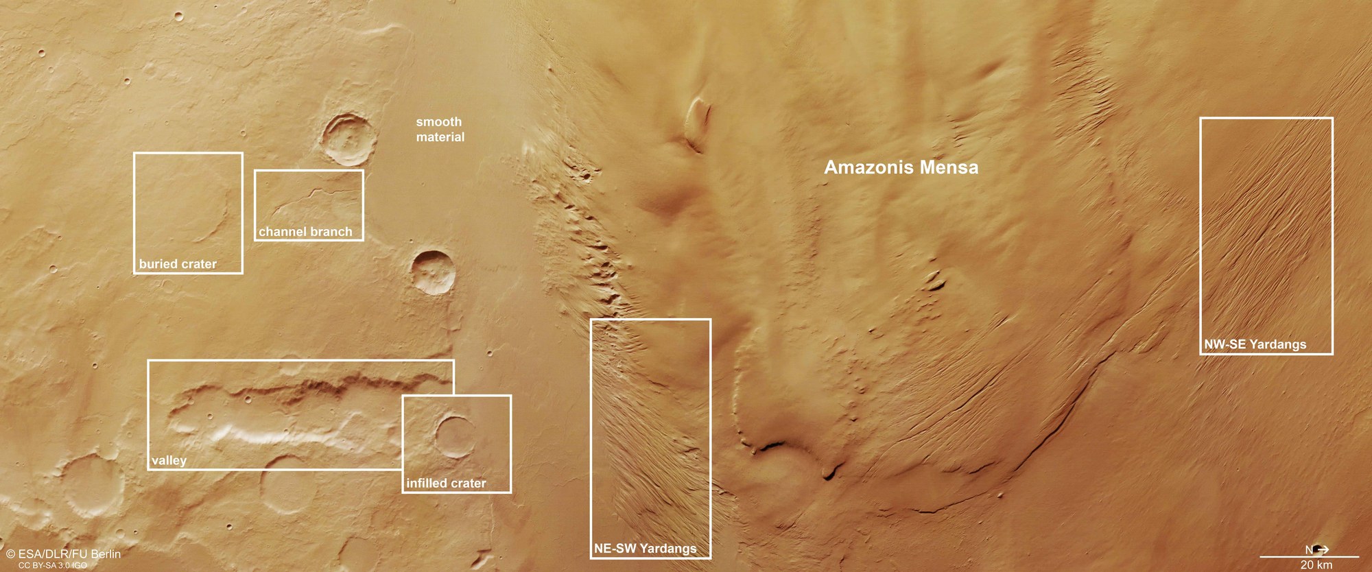
The region has a long history of volcanic activity and wind erosion, as shown by the shape and texture of the surface. On the left-hand, southern side of the image, several impact craters can be seen. Some are filled with smooth material, while others have largely retained their original internal structure.
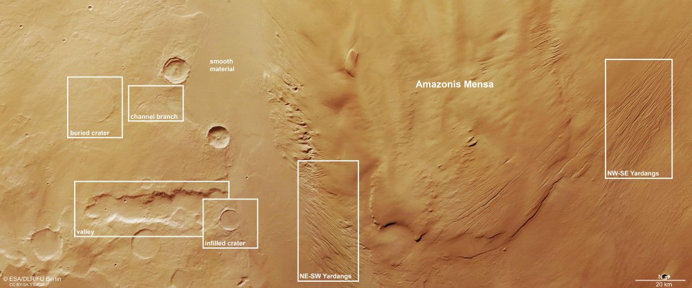
Top view – Amazonis Mensa and its 'neighbourhood'
The view shows characteristic features of the region around Amazonis Mensa. In the left half of the image is a long, comparatively wide valley. A few kilometres further west, above it in the image, is a narrow channel, which ends abruptly at a very smooth surface, most likely the remains of lava flows. Some impact craters were also partly filled in or completely buried by the lava. In the centre and on the right of the image are elongated, narrow ridges known as yardangs.
The images also reveal a comparatively wide valley approximately 50 kilometres long. A few kilometres further west (above it in the image) lies a narrow channel that, like the valley, ends abruptly at a very smooth surface. This surface is most likely the remains of lava flows from Mars' early history. These flows overlaid existing valleys, channels and impact craters – some of which were filled in, while others were completely buried. In doing so, these lava flows fundamentally reshaped the landscape of this region.
The power of the wind
Although Mars' atmosphere is extremely thin compared with Earth's, wind has also left clear traces in the region around Amazonis Mensa. Particularly striking are the prominent linear ridges known as 'yardangs'. These elongated, narrow ridges are formed by wind erosion: sand particles carried by the wind act like a natural sandblaster, gradually wearing away the surface over long periods of time.
The yardangs are oriented in different directions due to wind currents that were influenced and deflected by the topography of Amazonis Mensa. Each yardang is aligned parallel to the prevailing wind direction. For the wind to have eroded it so extensively, Amazonis Mensa must also consist of relatively soft material.
Background info – image processing
The images were captured by the HRSC on 14 June 2026 during Mars Express orbit 28,328. The ground resolution is approximately 24 metres per pixel, and the centre of the image is located at approximately 3 degrees South and 215 degrees East.
The colour image was created using the nadir channel – whose field of view is directed perpendicular to the Martian surface – together with the HRSC's colour channels. The oblique perspective view was generated from the digital terrain model, together with the HRSC's nadir and colour channels. The anaglyph image, which provides a three-dimensional impression of the landscape when viewed with red-blue or red-green glasses, was derived from the nadir channel and one stereo channel. The colour-coded topographic view is based on a digital terrain model of the region, from which the topography of the landscape can be derived.
The High Resolution Stereo Camera was developed at DLR and built with contributors from industry (EADS Astrium – now Airbus; Lewicki Microelectronic and Jena-Optronik). The research team, led by Daniela Tirsch, Principal Investigator (PI), comprises 50 co-investigators from 35 institutions in 11 countries. The camera is operated by the DLR Institute of Space Research (formerly the DLR Institute of Planetary Research) in Berlin-Adlershof.